“Holeylan Plain” is one of the very ancient regions of western Iran. It is full of prehistoric and ancient Iranian works, with many cemeteries, remnants of old forts and hills. Parts of this extensive collection have been explored with the help of archaeologists, and other parts require speculation.
The oldest signs of human groups in western Iran have been found in the Holeylan plain and valley. This plain has at least seven ancient areas near Simareh river and is one of the most important human habitats in the entire Iranian plateau. They were close to the Mesopotamia civilizations, and lived along the historic road that stretched from Susa to Akbatan. In the Holeylan plain, a Neolithic society was found between 6500 and 5500 BC. This civilization reveals the first signs of nomadic life in the plateau of Iran.
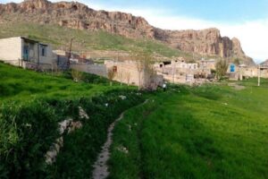
Holeylan plain is located in Shirvan-va-chardavol district, in Ilam province. There are signs from the neolithic period and can be seen from Shiravand village. Archaeologists who have explored the Holeylan Plain believe that the first inhabitants of this civilization were nomadic shepherds and had small huts with stone foundations and mud walls. They plastered their houses’ walls with clay, built rooms that had built-in stone benches; and covered the floor with a type of lime.
Archeologists have also discovered that the first habitats of Holeylan plain were unaware of the technique of farming; however, in a period after that there was a change in their lives, and they started farming. This has been found from the tools that were excavated in the higher layers. From animal bones they made objects like beads and flags, and also small statues. They also buried their dead and put some objects in the graves that they thought would be helpful for the dead in their afterlife. However, there may have been changes in the burial method of Holeylan prehistoric people in the periods after that. They used to go to the northern heights in the summers.
The first archaeological excavations in the Holeylan plain were carried out in 1313 (1934) with the help of German archaeologist Eric Schmidt. He photographed the area and found ancient pottery in his excavations. Two years later, another archaeologist, Aurel Stein, followed up the excavations and identified other mounds and regions. Between 1342 (1962) and 1346 (1967), Mrs. Clare Goff, an English archaeologist, investigated Holeylan Plain. In 1315 (1936), two seasons of archaeological excavations were carried out in the Holeylan plain, and more than 160 ancient sites were discovered, and the importance of this area became more apparent.
Holeylan Hill is 10 meters high. As we mentioned, the remnants of houses were found there, which belonged to prehistoric cattle breeders. They were the first nomadic people who came to this plain during winter. Their habitat and construction method in the Neolithic period is not like anywhere else in Iran and the Middle East and is one of the first types of nomadic life. Numerous pottery has been discovered in the Holeylan plain: gray pottery, simple pea pottery, patterned pottery, and red pottery. Another point about the Holeylan plain and its remarkably ancient area is the many holes visible in aerial photographs. Antiquarians and unauthorized diggers have excavated these places to find imaginary treasure, and thus have caused a lot of damage to this ancient expanse.